
Some flakes possible in Northeast PA today and a big snowstorm in New England…
A strong Nor’easter has formed just northeast of our area, sparing our area, but bringing a big snowstorm to New England, with 1-2 feet of snow in the mountains of New England and possibly as much as 3-4 feet in the highest elevations in New Hampshire. The accumulating snow will come as close to our area as far northern northwest Connecticut, with significant accumulations in Northeastern Connecticut. There could even be some snow flurries or showers in Northeastern PA today that could leave a coating in the highest elevations, with sprinkles or a shower possible elsewhere. Highs will be in the mid 40’s to mid 50’s.
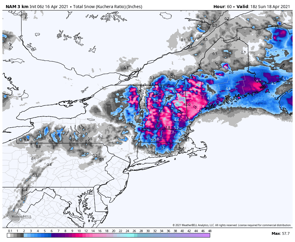
Below is the latest snow map from the short-range American model for today, courtesy WeatherBell Analytics. Click on the image to enlarge.
Tomorrow will be variably cloudy with highs in the mid 40’s to mid 50’s.
Sunday will be variably cloudy with a chance of a sprinkle. Highs will be in the mid 50’s to low 60’s.
Monday will be variably cloudy with a chance of a shower or sprinkle. Highs will be in the upper 50’s to mid 60’s.
Tuesday will be variably cloudy and warm with highs in the 60’s.
Wednesday, clouds will increase with a chance of a shower in the morning and then showers will be likely in the afternoon, ending at night, as a cold front passes through our area. Highs will be in the mid 50’s to mid 60’s.
Thursday and next Friday, April 23rd, will then be mostly sunny with highs rising from the mid 40’s to mid 50’s Thursday to the mid 50’s to low 60’s next Friday.
Next Saturday, April 24th, there will be a chance of showers as a cold front and disturbance approach our area. Highs will be in the mid 50’s to low 60’s.
Next Sunday, April 25th, there will be a chance of showers ending in the morning as the cold front passes through our area. Highs will be in the mid 50’s to low 60’s.
Next Monday, April 26th, through next Thursday, April 29th, are currently looking nice with highs gradually rising from the 50’s next Monday, to the mid 50’s to low 60’s next Tuesday, and the upper 50’s to mid 60’s next Wednesday and Thursday.
No comments:
Post a Comment
Note: Only a member of this blog may post a comment.