Snow today throughout our area, significant in northern sections and very significant in far northern sections…
Any remaining rain will change to snow throughout our area today as a Nor’easter develops off the coast. The snow will end tonight.
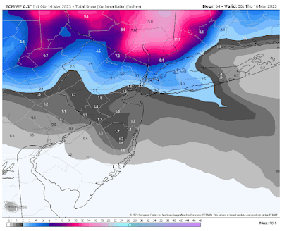
Total Possible Snowfall Accumulation:
Trace to an inch: Southern PA and Southern NJ
1-2 inches: Central NJ and Eastern Long Island
1-3 inches: East Central PA, NYC, Western half of Long Island
2-8 inches from south to north: Northern NJ
3-8 inches: Northeastern PA, Coastal and Southeastern Fairfield County, CT
5-15 inches: Southeastern NY State and Northwestern Fairfield County, CT
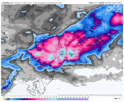
Below is the latest European model snow map for today, courtesy WeatherBell Analytics. Click on the image to enlarge.
After this storm passes temperatures will gradually warm from the mid 30’s to mid 40’s tomorrow to the mid 40’s to mid 50’s Thursday and the 50’s to low 60’s Friday.
Clouds will increase Friday with a chance of a shower at night as a cold front passes through our area.
Saturday through next Tuesday will then be nice.
Next Wednesday we will then have a chance of rain or snow as a disturbance approaches our area from the Southeastern United States.
Next Thursday will be nice, followed by a chance of a shower next Friday, rain next Saturday, and a rain or snow shower next Sunday.


No comments:
Post a Comment
Note: Only a member of this blog may post a comment.