
There is the potential for ice this weekend as a disturbance passes though our area and the potential for significant icing Tuesday as an even stronger disturbance passes through our area.
It is too early to give any specifics right now, other than to say that parts of our area could see some icing in the coming days.
Below is the latest short-range American model sleet map for Saturday Night and Sunday, courtesy WeatherBell Analtyics. Click on the image to enlarge.

And below is the latest short-range American model freezing rain map for Saturday Night and Sunday, courtesy WeatherBell Analtyics. Click on the image to enlarge.

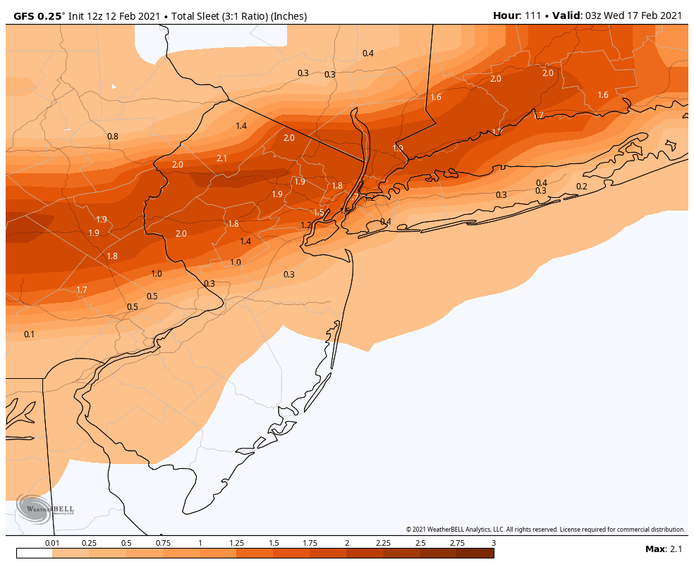
And then below is the latest medium-range American model sleet map for Tuesday morning, courtesy WeatherBell Analtyics. Click on the image to enlarge. Now that would be an awful lot of sleet!
And then below is the latest medium-range American model freezing rain map for Tuesday morning, courtesy WeatherBell Analtyics. Click on the image to enlarge.

Send weather related photos or videos to edgeweather2@gmail.com
Follow this blog @TheEdgeWeather on Twitter or Facebook.
Also, you can access this blog at the following web addresses: edgeweather.com, theedgeweather.com, edgeweather.net, theedgeweather.net, edgeweather.us, theedgeweather.us, edgeweather.org, theedgeweather.org, and theedgeweather.blogspot.com
No comments:
Post a Comment
Note: Only a member of this blog may post a comment.