Below is the snow map from the latest run of the European model courtesy WeatherBell Analytics. Click on the image to enlarge.
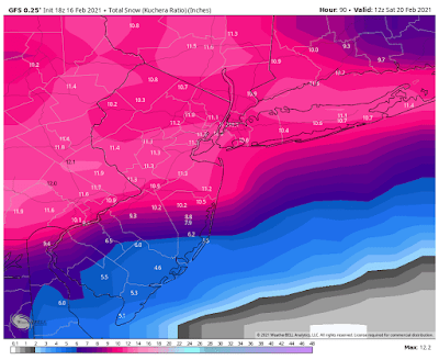
Below is the snow map from the latest run of the Medium-range American model courtesy WeatherBell Analytics. Click on the image to enlarge.
Below is the snow map from the latest run of the Medium-range Canadian model courtesy WeatherBell Analytics. Click on the image to enlarge.
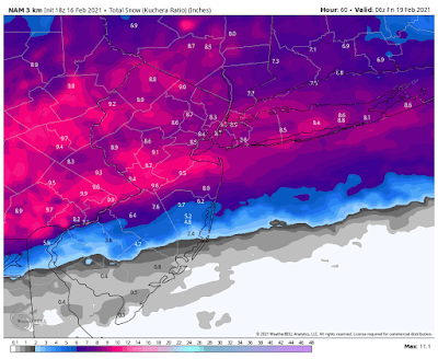
Below is the snow map from the latest run of the short-range American model courtesy WeatherBell Analytics. Please keep in mind that this model is a short-range model and cuts off at 60 hours, so ends at 1 am on Friday morning and the storm may continue on until Friday morning, so this model is not capturing the entire storm. Click on the image to enlarge.
Send weather related photos or videos to edgeweather2@gmail.com
Follow this blog @TheEdgeWeather on Twitter or Facebook.
Also, you can access this blog at the following web addresses: edgeweather.com, theedgeweather.com, edgeweather.net, theedgeweather.net, edgeweather.us, theedgeweather.us, edgeweather.org, theedgeweather.org, and theedgeweather.blogspot.com


No comments:
Post a Comment
Note: Only a member of this blog may post a comment.