
Some snow possible tomorrow night into Tuesday morning and then watching for a potential Nor’easter Saturday…
Some snow will be possible tomorrow evening as a weak disturbance passes through our area. There is the potential for a 20 or 30 mile wide band of snow to develop somewhere in our area tomorrow night into Tuesday morning. There is even a small chance for a significant band of snow to develop tomorrow night into Tuesday morning, but it is still too early to tell exactly where this band will develop, if it does, so be sure to check back for updates tomorrow.
Below is the latest snow map from the medium range American model, courtesy WeatherBell Analytics. Clik on the image to enlarge.

After this disturbance passes the next systems to watch will be two disturbances approaching from the west that may combine to form a Nor’easter along the Middle Atlantic Coast Saturday. There is the potential for this storm to be quite significant IF the pieces come together perfectly and depending on the exact track if the pieces do come together.
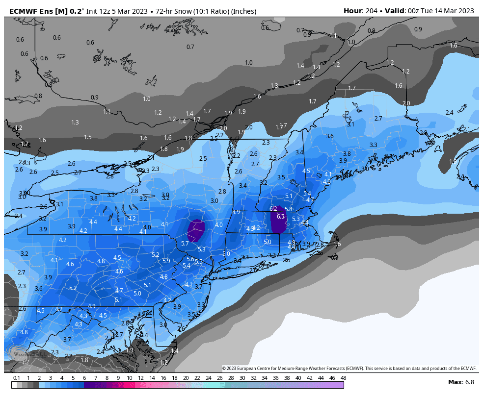
Below is the latest snow map from the European model ensemble mean, courtesy WeatherBell Analytics. Click on the image to enlarge.
The next storm to watch will then be the following weekend with a chance for rain or snow.
No comments:
Post a Comment
Note: Only a member of this blog may post a comment.